Assessments

ASSESSMENT IS THE ENGINE THAT DRIVES YOUR PROJECT
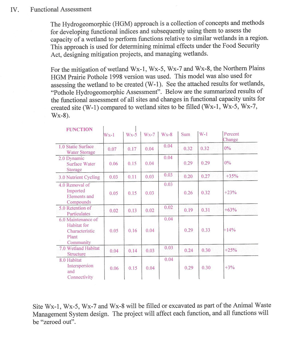
WSI uses state-of- the-art technology tools to streamline our wetland assessment services. As assessments are considered instrumental in many state-level wetland monitoring and regulatory programs, we provide specialized expertise that enables our clients to easily navigate regulatory compliance for these types of programs. We have over 30 years of experience using prairie potholes, riverine, and sloped USACE models to assess wetland functions. By utilizing Geographic Information System (GIS) techniques our client’s projects benefit with improved consistency, speed, accuracy, and transparency.
Specifically, WSI provides the following services:
- Perform Corps of Engineers modeling for hydrogeomorphic modeling of functions of prairie potholes, intermittent stream, riverine and slope wetlands
- Calculate computations of wetlands functions (credits / assessments)
- Gather data while onsite and using GIS tools


