Planning
PLANNNG FOR SUCCESS
As we are planning, we take into account our client’s project objective, regulatory requirements, and the community’s culture to provide proposals, methods and procedures derived from sound science and data analysis. Developing tactics, creating strategic partnerships, and building relationships are part of our mission. Planning involves a clear eye for detail, clarity of purpose, and shared vision – WSI makes that happen. Our planning processes takes the guesswork out of a project. Whether your project is focused on risk reduction, data collection and analysis, or high quality, priority-driven technical objectives, our plans effectively communicate a wealth of information.
Specifically, WSI provides the following planning processes:
- Vegetation Mapping
- Soil Mapping
- Sampling/reporting
- Geospatial statistical analysis/reporting/mapping
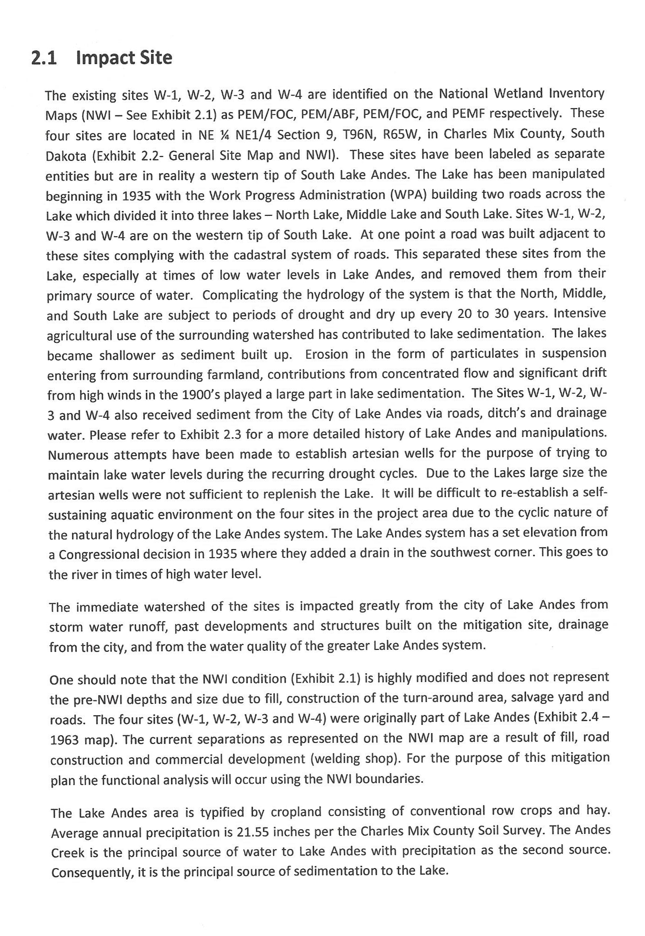
- Compliance determinations/planning/reporting
- Site-design coordination
- Wetlands restoration plans
- Wetland ordinance planning/drafting
- Permit writing and assistance
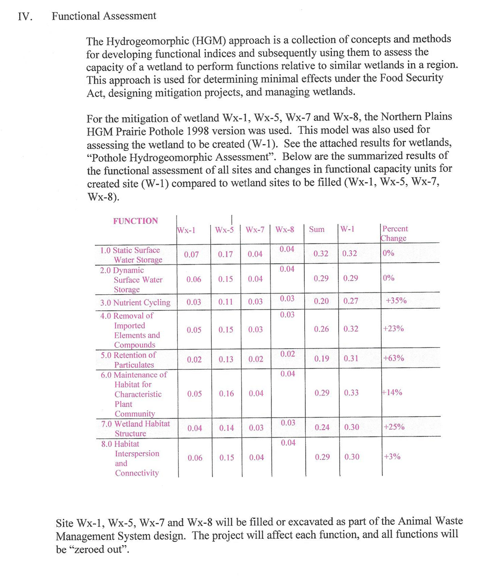
- Wetland functional assessments/calculations (credit analysis)
- Watershed delineation and analysis mapping
- Mitigation plans
- Monitoring reporting